- The Silmarillion
- The Hobbit
- The Fellowship of the Ring
- The Two Towers
- The Return of the King
- Appendices
- City or town
- Fortress or tower
- Ruin
- Cave or underground hall
Welcome to Middle-earth
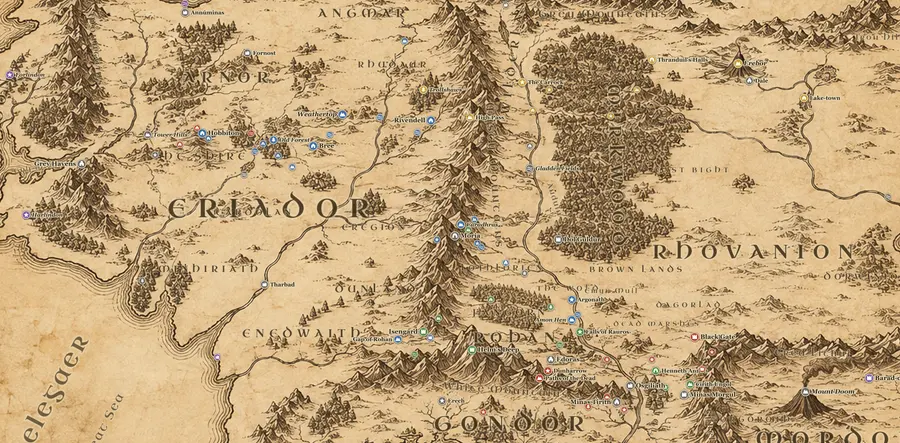
An original interactive map of Tolkien's world, with every important place and event from The Hobbit, The Lord of the Rings and The Silmarillion plotted as markers.
- · Click a marker or an event to read about it
- · Use the side panel to filter by book or draw the journeys
- · Hit Play the story to follow Frodo from Bag End to Mount Doom
Interactive Middle-earth Map
Explore an original interactive map of Middle-earth: 156 place pages, 13 regions, nine character journeys, a timeline and a distance calculator.
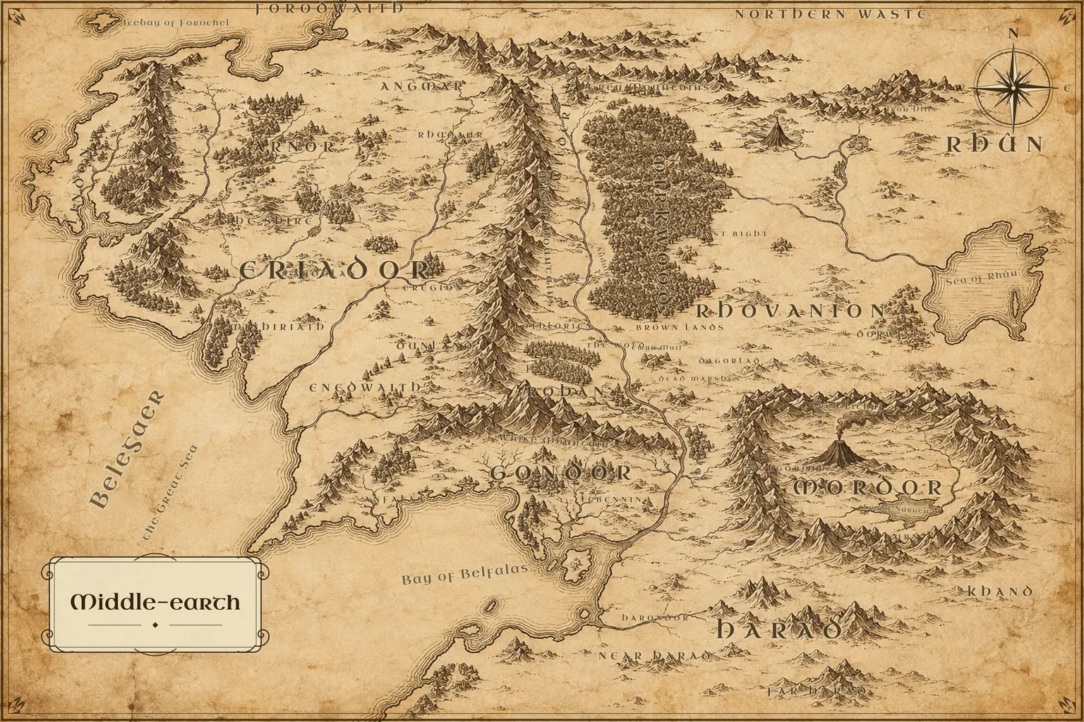
A map of Middle-earth shows the northwest of Tolkien's world, from the Grey Havens on the west coast to the ash plains of Mordor in the southeast. Between them lie the Shire, the ruined kingdoms of Eriador, the Misty Mountains, Mirkwood, the grasslands of Rohan and the stone cities of Gondor. North of that band is the frozen Forodwaith. East are the Sea of Rhûn and Khand. South, past the river Harnen, is Harad.
Start with the full view, then zoom in. Labels appear as you go, so a wide view shows realms, rivers and mountain ranges, while a close view shows single fords, farms and towers. Click any label to open a place page with its position, its history, the events that happened there and a short FAQ. The search box accepts alternate names, so Imladris, Mithlond and Khazad-dûm all find the right marker.
The map is an original artwork made for this site. Nothing is scanned or traced from a published edition, so it is free to download. All 156 marked places have their own page, and the 13 regions each open at their own zoom level. Nine journeys, including Bilbo's road to Erebor and Frodo's road to Mount Doom, can be drawn across the map with their stops and dates. A distance calculator measures between any two points, and the whole site reads in ten languages.
How to read a map of Middle-earth
- 01
Find the four edges
Start with the borders. The Great Sea, Belegaer, fills the west, so every coast on the left is ocean. The east runs out past the Sea of Rhûn toward Khand and lands Tolkien never mapped. North is the cold Forodwaith above Angmar. South is Harad, beyond the bay at Umbar. The mapped area is roughly 1,300 miles wide.
- 02
Follow the Misty Mountains
Next find the Misty Mountains, called Hithaeglir. They run about 800 miles north to south, from Mount Gundabad down to Methedras, and they cut the map in two. West of them is Eriador, holding the Shire, Bree and Rivendell. East is Wilderland, with Mirkwood and Erebor. Only three crossings matter: the High Pass, the Redhorn Gate and Moria.
- 03
Trace the Anduin
Then follow the Anduin, the Great River. It rises north of Mirkwood and runs some 1,300 miles south to its delta in the Bay of Belfalas. On the way it passes the Gladden Fields, Lothlórien, the pillars of the Argonath, the falls of Rauros and ruined Osgiliath. Nearly every journey in the books crosses it at least once.
- 04
Place the realms
Last, fix the kingdoms. The Shire and Bree sit in western Eriador. Rohan holds the grassland between the Misty Mountains and the White Mountains, with Edoras near its center. Gondor lies south of the White Mountains, around Minas Tirith. Mordor is the square of mountain walls east of the river, with Barad-dûr and Mount Doom inside.
About this interactive Middle-earth map
What the interactive map does
This is a free, interactive Middle-earth map of the lands in The Hobbit and The Lord of the Rings. The painted base map covers everything from the Grey Havens and the Blue Mountains in the west to the Sea of Rhûn in the east, and from the Forodwaith in the north to Harad and Umbar in the south. On top of it sit 156 clickable places, 13 regions, nine character journeys and almost 400 dated events. Nothing needs installing and there is no account: open the page, drag the map, and scroll or pinch to zoom.
Every marker opens a short card with what happened there, which books mention it and which journeys pass through, with a link to a full place page. The search box knows alternate names, so Imladris finds Rivendell, Mithlond finds the Grey Havens and Khazad-dûm finds Moria. The measuring tool gives the distance between any two points in miles and kilometres, worked out on a to-scale grid rather than from the painting, which is not drawn to one scale everywhere.
The full map of Middle-earth, region by region
Many sites show only a cropped corner around the Shire or Mordor. This one shows the full Middle-earth map of the Third Age, with each region labelled: Eriador and the Shire, Rhovanion and Mirkwood, Rohan, Gondor, Mordor, Rhûn and Harad. Zooming in turns it into a more detailed Middle-earth map. Pins for towns, fortresses, fords and hills appear as you go, so the wide view stays readable while the close view shows single places such as Weathertop, the Ford of Bruinen or the Cross-roads in Ithilien. The 13 region pages each open the map at the right zoom and list the places inside them.
A Lord of the Rings Middle-earth map, stop by stop
A LOTR Middle-earth map is really a map of journeys, so the routes here are drawn from the books. Frodo and Sam's road runs from Hobbiton through Bree, Rivendell, Moria and Lothlórien, down the Anduin to the Emyn Muil, across the Dead Marshes and through Ithilien to Cirith Ungol and Mount Doom, then home to the Shire and on to the Grey Havens. Aragorn's road through the Paths of the Dead, Merry and Pippin's capture by the Uruk-hai, Gandalf's errands, Gollum's long hunt, Boromir's ride north and the charge of the Rohirrim each have their own line.
Press Play the story and the map follows a journey stop by stop, with the date from Appendix B for each leg. The events in the side panel are sorted the same way and grouped by volume, so you can watch The Fellowship of the Ring, The Two Towers and The Return of the King unfold across the map.
Tolkien's Middle-earth beyond The Lord of the Rings
Tolkien's Middle-earth map changed over the Ages, and the site covers more than the War of the Ring. The Hobbit has its own route, from Bag End over the Misty Mountains and through Mirkwood to Erebor and back. Older history is tied to the places where it happened: the fall of Arnor at Fornost, the Kin-strife of Gondor, the Last Alliance on the Dagorlad and the First Age on the western coast where Beleriand sank. The timeline puts all of it in order, and every date follows the books and their appendices rather than the films.
High resolution and HD downloads
If you want a high resolution Middle-earth map for a screen or for print, the download page has the full map as a PNG at 1920 or 3072 pixels wide, and as an SVG with sharp vector markers over the 3072-pixel artwork. The 3072 px file is the highest quality version we have. It is larger than a 1080p HD screen and covers most of a 4K display, but it is not a 4K scan, and we would rather say so than stretch the image and call it one.
The files are free for personal use: wallpaper, school work, reading notes or a handout for your own game. Please link back to this site if you share the map, and do not resell it.
Printing a poster, and other ideas
A Middle-earth map poster is the most common reason people download it. The 3072 px PNG prints cleanly at about A3; larger than that the painted texture softens up close, although it still reads well from across a room. Matte paper holds the sepia tones better than gloss. People also ask about a Middle-earth map blanket, a tattoo or other keepsakes. We do not sell products, and printed goods for sale would need permission, because the names and the world belong to the Tolkien Estate. For a tattoo, the map works well as a reference to give your artist, who can redraw the part you care about, such as the Shire or the Lonely Mountain.
Using the map for tabletop games
Game masters running Adventures in Middle-earth, The One Ring or a homebrew campaign use the map to plan routes and check travel times. The distance tool gives straight-line miles, and the journey pages list how many days the characters in the books took over the same ground, which is a useful yardstick for a party on foot or on horseback.
How accurate is it?
Tolkien's own maps disagree in places, and large areas were never drawn in detail, so any map involves judgment. The coastlines, mountain chains and rivers follow the published maps closely enough to find your way, but the painting is an original artwork made for this site, not a copy of any edition, and small hills, forest edges and river bends are its own. Where the books only hint at a location, the place page says so. Distances come from the to-scale grid, based on Karen Wynn Fonstad's Atlas of Middle-earth, so they stay consistent even where the artwork is stretched.
Regions and realms
Thirteen regions, from Lindon on the west coast to Rhûn in the east, each with its own map view and list of places.
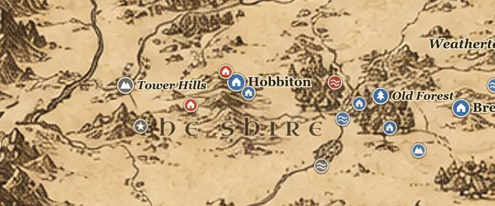
The Shire
The green homeland of the hobbits, set in northwest Eriador between the Far Downs and the Brandywine
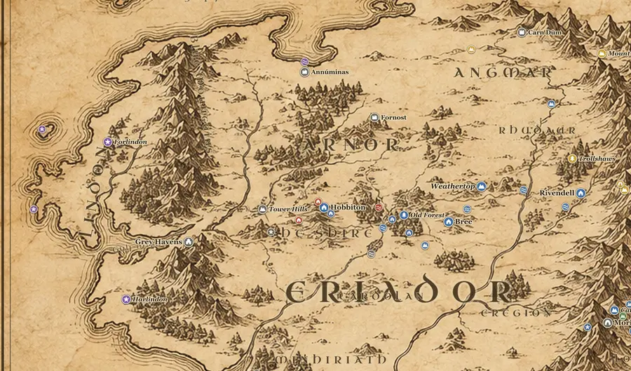
Lindon
The last Elvish coastland west of the Blue Mountains, where ships leave Middle-earth from the Grey Havens
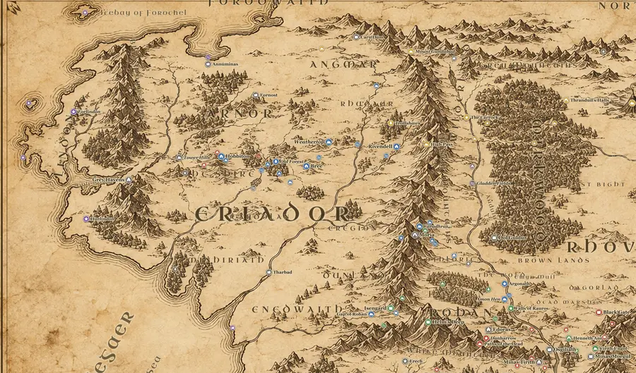
Eriador
The wide empty country between the Blue Mountains and the Misty Mountains, full of ruined kingdoms
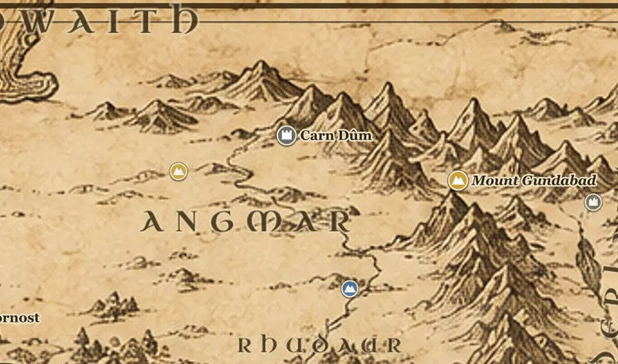
Angmar
The cold northern realm of the Witch-king, set where the Misty Mountains meet the Ettenmoors
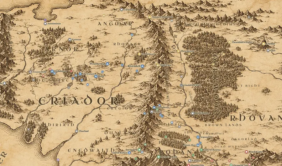
Misty Mountains
The long north-south wall of peaks that splits Middle-earth, pierced by Moria and the High Pass
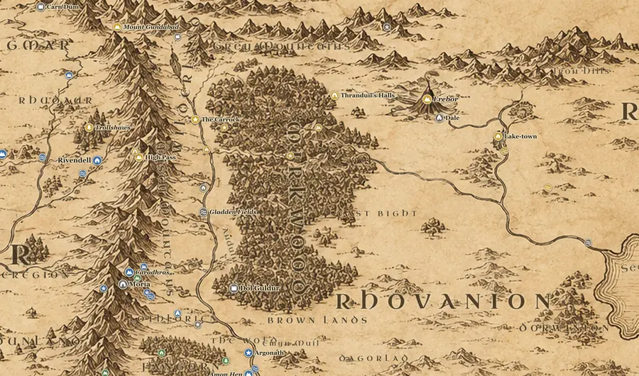
Rhovanion
The wide wilderland east of the Misty Mountains, cut in two by the Great River Anduin
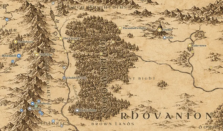
Mirkwood
The great dark forest of Wilderland, once called Greenwood the Great before a shadow settled on it
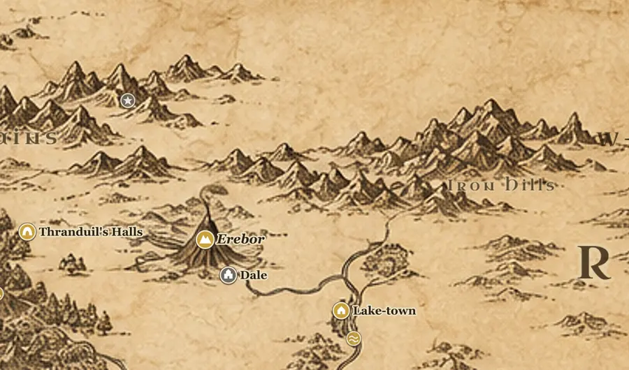
Dale and Erebor
The dwarf-kingdom under the Lonely Mountain and the town of Men beside it, in the far northeast
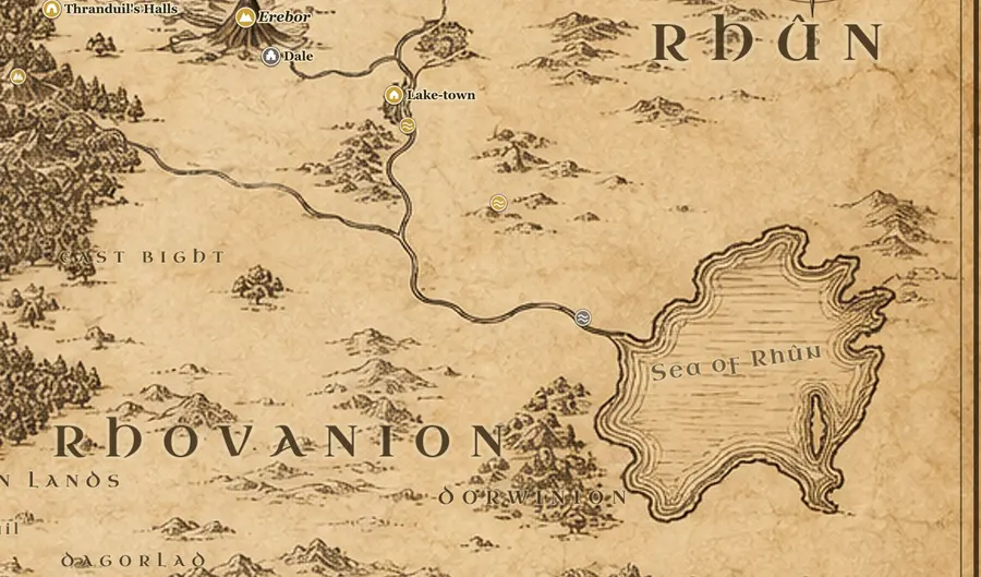
Rhûn
The far eastern lands beyond the inland Sea of Rhun, home of the Easterlings who served Sauron
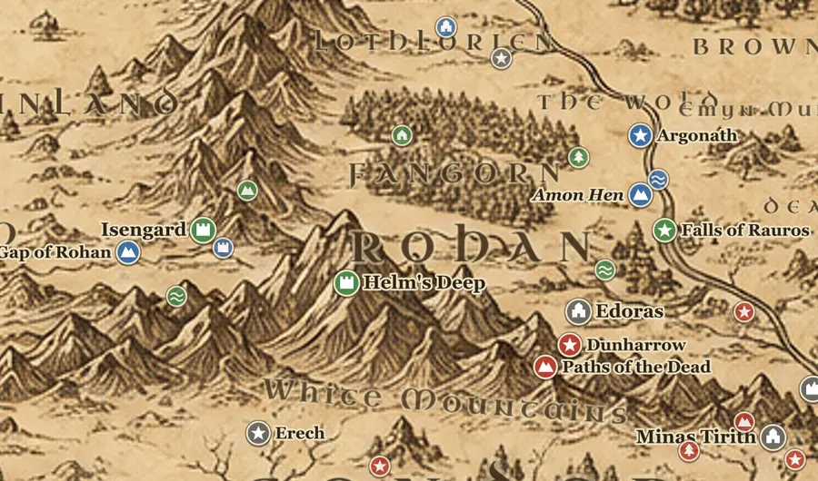
Rohan
The grass kingdom of the horse-lords, between the White Mountains and the River Limlight
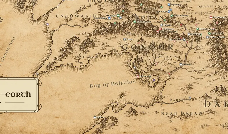
Gondor
The last great kingdom of Men in the south, from the White Mountains to the Bay of Belfalas
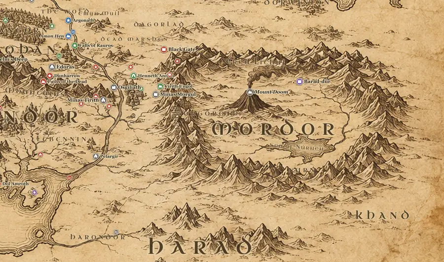
Mordor
Sauron's walled land in the southeast, ringed by mountains and lit by the fires of Mount Doom
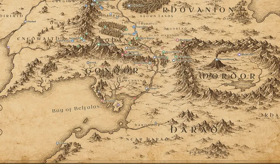
Harad
The hot southern lands beyond the Poros, home of the Haradrim and the corsairs of Umbar
Character journeys
Nine routes drawn across the map, with every stop in story order, the dates and the days spent on the road.
All journeys- There and Back Again Bilbo Baggins and Thorin’s Company 16 places
- The Road to Mount Doom Frodo and Sam 25 places
- The Fellowship of the Ring The Nine Walkers 10 places
- The Return of the King Aragorn, Legolas and Gimli 13 places
- Captured by the Uruk-hai Merry and Pippin 6 places
- Gandalf’s Errands Gandalf the Grey 15 places
- The Long Hunt Gollum (Sméagol) 12 places
- Boromir’s Errand Boromir of Gondor 6 places
- The Ride of the Rohirrim Théoden, Éowyn and Merry 5 places
Places on the map
All 156 marked places have a page: where it stands, who held it, what happened there and what lies nearby.
Frequently asked questions
Where is the Shire on the map of Middle-earth?
The Shire is in the far northwest of the map, in western Eriador, west of the river Brandywine and south of the North Downs. Hobbiton sits near its center, on the Great East Road. From Hobbiton it is about 120 miles east to Bree and roughly 200 miles west to the Grey Havens. Distances are approximate, based on Karen Wynn Fonstad's Atlas.
How big is Middle-earth?
Tolkien never published a total figure. The area on the familiar map is about 1,300 miles from the Grey Havens east to the Sea of Rhûn, and about 1,200 miles from the Icebay of Forochel south to Umbar, so it is comparable in size to Europe. Much more land lay east and south, off the edges of the map. These are approximate scale readings.
How far is it from the Shire to Mordor?
By the route Frodo and Sam actually walked, Hobbiton to Mount Doom is about 1,800 miles. In a straight line it is closer to 1,300. They left Bag End on 23 September TA 3018 and reached the Mountain on 25 March TA 3019, which is 183 days. Mileages are approximate estimates from Fonstad's Atlas.
Is Middle-earth based on Europe?
It is meant to be our own world at an imagined earlier time, not a copy of modern Europe. Tolkien wrote in his letters that Hobbiton stands at roughly the latitude of Oxford and Minas Tirith at roughly that of Florence, with the Mediterranean answering to the Bay of Belfalas. The coastlines and rivers are invented, so no real map lines up with it.
Where is Mordor on the map?
Mordor lies in the southeast, east of the Anduin and south of the Dead Marshes. Three mountain walls enclose it: the Ephel Dúath on the west, the Ered Lithui on the north, and the hills around the inland Sea of Núrnen in the south. From the Black Gate at its northwest corner to Núrnen is roughly 400 miles. Mount Doom stands alone in the plain of Gorgoroth, with Barad-dûr on a spur to the east.
Where is Rivendell on the map?
Rivendell, or Imladris, is in a hidden gorge on the western side of the Misty Mountains, just above the Ford of Bruinen and below the High Pass. On the map it sits east of Weathertop at the end of the Great East Road. Hobbiton to Rivendell is about 460 miles by road, Bree to Rivendell about 340 miles, and Bree to Weathertop about 100 miles. All approximate.
What is west of the Shire?
Going west from Hobbiton you pass the Far Downs, then the Tower Hills with their three elf-towers, then Lindon and the Gulf of Lune. The Grey Havens stand on the Lune, roughly 200 miles from Hobbiton, and elven ships sailed from there into the West. Beyond the coast is the Great Sea, Belegaer, and past it the lands the Silmarillion calls Aman.
What is the route in The Hobbit?
Bilbo travels west to east: Hobbiton, Bree, the Trollshaws, Rivendell, the High Pass over the Misty Mountains, the Carrock, Beorn's hall, Mirkwood by the Forest Gate, Thranduil's halls, Lake-town, and finally Erebor and Dale. The outward road is roughly 1,000 miles. He left on 27 April TA 2941 and came home on 22 June TA 2942.
Is this Middle-earth map interactive?
Yes. You can drag and zoom it, click any of the 156 markers for a short history, search by name or alternate name, draw nine journeys from the books with their dates, play a journey stop by stop and measure the distance between two points. It works in the browser on desktop and mobile, with no sign-up.
Can I download a high resolution Middle-earth map?
Yes, for free. The download page has the full map as a PNG at 1920 or 3072 pixels wide and as an SVG. The 3072 px version is the highest quality file: sharper than HD, though not a true 4K image. The files are for personal use; please link back if you share them.
Can I print it as a Middle-earth map poster?
Yes, for your own wall. The 3072 px PNG prints well up to about A3; at larger sizes it softens up close but still looks good from a distance. Matte paper suits the sepia tones. Selling prints is not allowed.
Is this the full map of Middle-earth from The Lord of the Rings?
It shows the whole area of the Lord of the Rings maps, from the Grey Havens to the Sea of Rhûn and from the Forodwaith to Harad, plus places from The Hobbit and events from The Silmarillion that happened on the same ground. Lands Tolkien never mapped in detail, such as the far East and the far South, are left open rather than invented.
Can I use this map for Adventures in Middle-earth or other tabletop games?
Yes, at your own table. Game masters use it to plan routes, check travel distances with the measuring tool and compare their party's pace with the days the characters took, which the journey pages list.
Can I use the map for a tattoo, blanket or other merchandise?
Personal inspiration is fine, for example as a reference for a tattoo artist. Making products to sell, such as blankets or posters, is not: the artwork is ours, and the names and the world belong to the Tolkien Estate.