Bridge · Eriador
Last Bridge
Bridge of Mitheithel
The one bridge over the Hoarwell, where Aragorn found a token that the road ahead was clear
- Appears in
- The Lord of the Rings
- Region
- Eriador
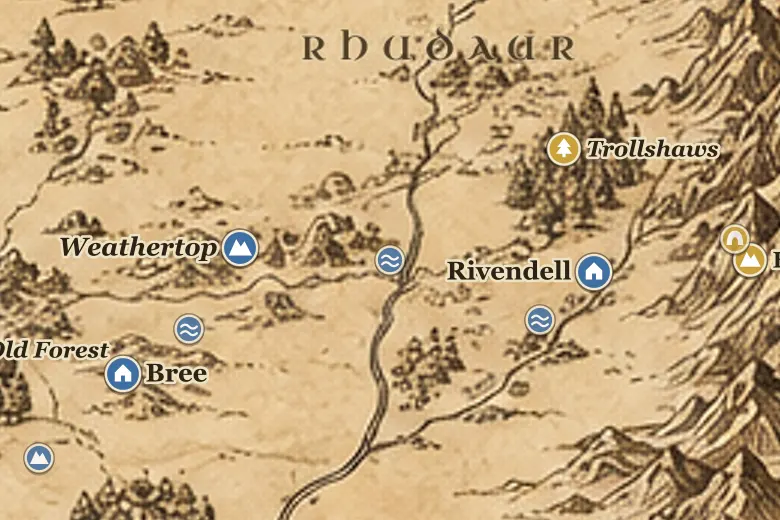
The bridge stands where the Great East Road meets the Hoarwell, east of the Weather Hills and west of the wooded country of the Trollshaws. Its name comes from being the last bridge on the road: from here to Rivendell the rivers have to be forded. The Hoarwell runs south from the Ettenmoors to join the Loudwater and become the Greyflood.
Aragorn approached it carefully in October TA 3018, expecting the Riders to be holding the crossing, since a hunted party with a wounded hobbit had no other way over. Instead he found a single pale green beryl lying on the parapet. He took it as a token deliberately left, evidence that Glorfindel had ridden that way and that the bridge was not watched, and led the company across in daylight.
The company left the Road soon after, turning north into the hills to avoid the open country, which is how they ended up among the stone trolls.
Events at this place
-
TA 3018, October 13 · The Lord of the Rings
The elf-stone on the parapet
On 13 October Aragorn found a beryl on the Last Bridge, left as a sign by Glorfindel, and judged the crossing safe for Frodo's party.
Frequently asked questions
Where is the Last Bridge on the Middle-earth map?
On the Great East Road where it crosses the river Hoarwell, between Weathertop and the Trollshaws.
Why is it called the Last Bridge?
It is the last bridged crossing on the road east. Beyond it the Bruinen has to be forded, at the Ford of Bruinen below Rivendell.