Mountain · Mirkwood
Mountains of Mirkwood
Emyn-nu-Fuin
The dark highland at the heart of Mirkwood, drawn on the Wilderland map
- Appears in
- The Hobbit
- Region
- Mirkwood
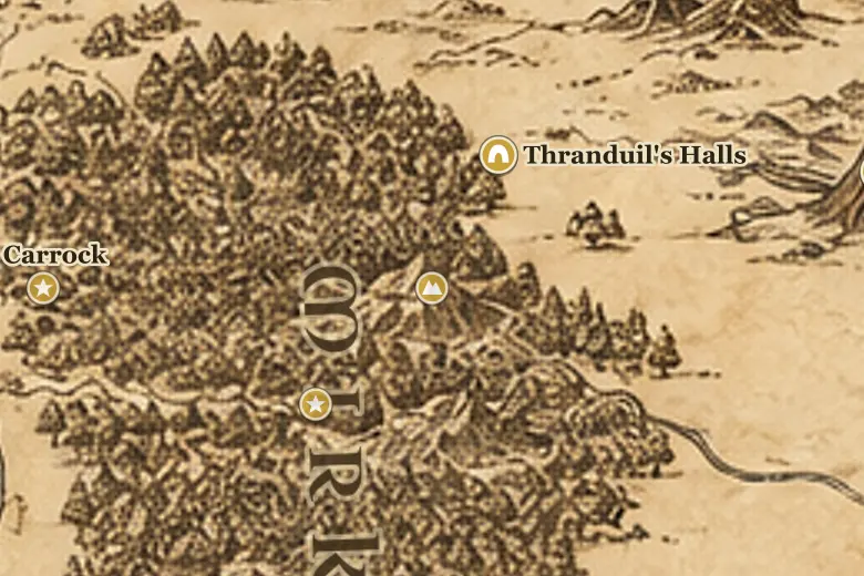
The Mountains of Mirkwood form a low, steep range running east to west across the center of the forest, between the Forest River country in the north and the Old Forest Road in the south. They are marked on the Wilderland map printed with The Hobbit rather than described at length in the text.
The Elf-path skirts their northern side. It was in this stretch that Thorin's company ran out of supplies, climbed a tree to look for the forest's edge and saw only a sea of leaves, and then left the path toward the Elves' fires and were taken by spiders.
The Sindarin name Emyn-nu-Fuin means hills under night, which echoes Mirkwood's other Elvish name, Taur-nu-Fuin, the forest under nightshade.
Events at this place
-
TA 2941 · The Hobbit
Lost on the Elf-path
Near the Mountains of Mirkwood the company's food ran out, Bombur fell into the enchanted stream, and the dwarves strayed from the path.
Frequently asked questions
Where are the Mountains of Mirkwood?
In the middle of Mirkwood, between the Elf-path to the north and the Old Forest Road to the south.
What does Emyn-nu-Fuin mean?
Hills under night in Sindarin, matching Taur-nu-Fuin, one of the Elvish names for the darkened forest.